- Главная
- Разное
- Бизнес и предпринимательство
- Образование
- Развлечения
- Государство
- Спорт
- Графика
- Культурология
- Еда и кулинария
- Лингвистика
- Религиоведение
- Черчение
- Физкультура
- ИЗО
- Психология
- Социология
- Английский язык
- Астрономия
- Алгебра
- Биология
- География
- Геометрия
- Детские презентации
- Информатика
- История
- Литература
- Маркетинг
- Математика
- Медицина
- Менеджмент
- Музыка
- МХК
- Немецкий язык
- ОБЖ
- Обществознание
- Окружающий мир
- Педагогика
- Русский язык
- Технология
- Физика
- Философия
- Химия
- Шаблоны, картинки для презентаций
- Экология
- Экономика
- Юриспруденция
Что такое findslide.org?
FindSlide.org - это сайт презентаций, докладов, шаблонов в формате PowerPoint.
Обратная связь
Email: Нажмите что бы посмотреть
Презентация на тему по английскому языку на тему Scenic Britain
Содержание
- 2. Britain’s complex geography encompasses a variety landscapes,
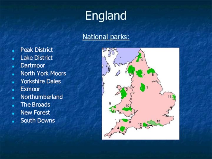
- 3. England National parks:Peak DistrictLake DistrictDartmoorNorth York MoorsYorkshire DalesExmoorNorthumberlandThe BroadsNew ForestSouth Downs
- 4. Peak DistrictMost of the area falls within
- 6. Lake District The Lake District, also known
- 8. DartmoorParts of Dartmoor have been used as
- 10. Exmoor is situated on the Bristol Channel
- 12. Yorkshire DalesIn 1954 was designated the Yorkshire
- 13. The Park has its own museum, the
- 15. Stonehenge
- 16. Scotland There are currently two national
- 17. Loch Lomond & The Trossachs National Park
- 19. The Cairngorms National Park The Cairngorms National
- 21. Scottish Highlands
- 22. Loch Ness Loch Ness is the
- 24. Famous Loch Ness Monster
- 25. WalesNational Parks:SnowdoniaPembrokeshire Coast National ParkBrecon Beacons National Park
- 26. SnowdoniaIt was established in 1951It covers 827 square
- 28. Pembrokeshire Coast National ParkPembrokeshire Coast National Park
- 30. Brecon BeaconsIt consists of the mountains to
- 32. Northern Ireland There are, at present, no
- 33. Mourne MountainsA mountain range located in County
- 35. Скачать презентацию
- 36. Похожие презентации
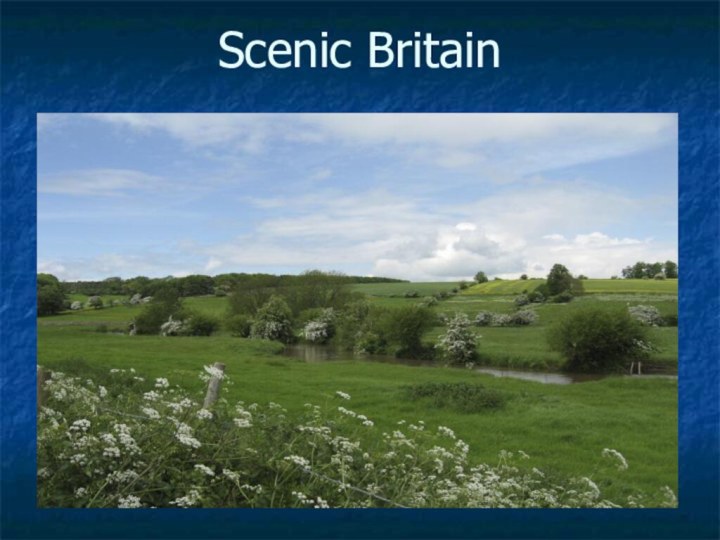
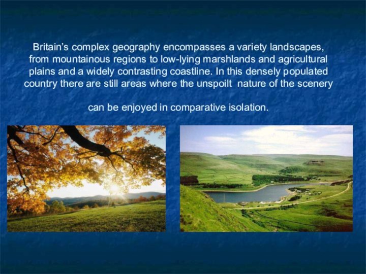
Britain’s complex geography encompasses a variety landscapes, from mountainous regions to low-lying marshlands and agricultural plains and a widely contrasting coastline. In this densely populated country there are still areas where the unspoilt nature of the












Слайд 3
England
National parks:
Peak District
Lake District
Dartmoor
North York Moors
Yorkshire Dales
Exmoor
Northumberland
The Broads
New
Forest
South Downs
Слайд 4
Peak District
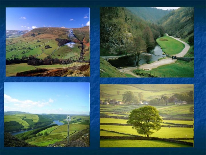
Most of the area falls within the
Peak District National Park, whose designation in 1951 made
it the first national park in the British IslesIt forms the southern end of the Pennines and much of the area is uplands above 1,000 feet (300 m), with a high point on Kinder Scout of 2,087 feet (636 m).
Слайд 6
Lake District
The Lake District, also known as The
Lakes or Lakeland, is a rural area in North
West England. A popular holiday destination, it is famous for its lakes and its mountains and its associations with the early 19th century poetry and writings of William Wordsworth and the Lake Poets.The Lake District has some of England’s most beautiful scenery.
It is a National Park owned by the National Trust which was set up in 1895 to protect the countryside and ancient buildings of England.
Слайд 8
Dartmoor
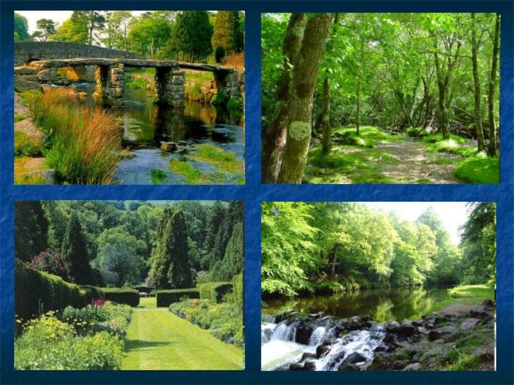
Parts of Dartmoor have been used as a
military firing
range for over two hundred
years. The public enjoy extensive access rights to the rest of Dartmoor, and it is a popular tourist destination.
The Park was featured on the TV programme Seven Natural Wonders as the top natural wonder in South West England.
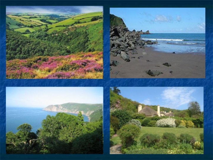
Слайд 10 Exmoor is situated on the Bristol Channel coast
of South West England.
The park straddles two counties,
with 71% of the park located in Somerset and 29% located in Devon. The total area of the park, which includes the Brendon Hills and the Vale of Porlock, covers 692.8 square kilometres (267.5 sq mi) of hilly open moorland and includes 55 kilometres (34 mi) of coast.
It is primarily an upland area with a dispersed population living mainly in small villages and hamlets.
The largest settlements are Porlock, Dulverton, Lynton, and Lynmouth, which together contain almost 40% of the National Park population.
Слайд 12
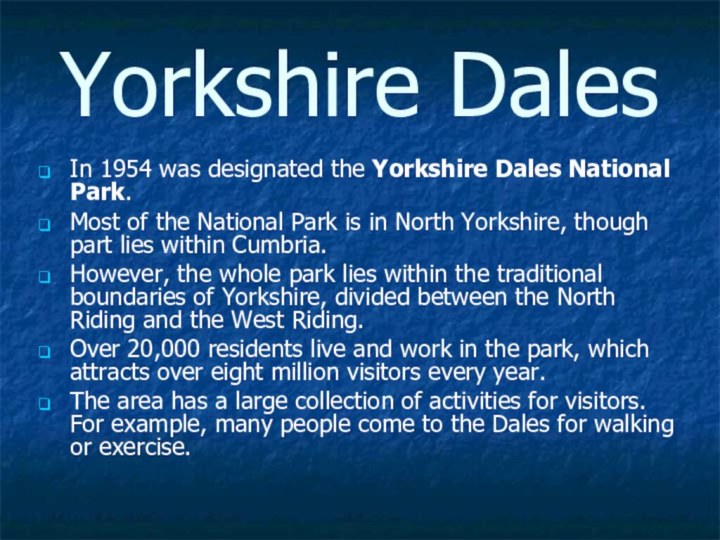
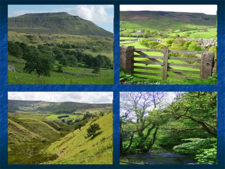
Yorkshire Dales
In 1954 was designated the Yorkshire Dales
National Park.
Most of the National Park is in
North Yorkshire, though part lies within Cumbria. However, the whole park lies within the traditional boundaries of Yorkshire, divided between the North Riding and the West Riding.
Over 20,000 residents live and work in the park, which attracts over eight million visitors every year.
The area has a large collection of activities for visitors. For example, many people come to the Dales for walking or exercise.
Слайд 13 The Park has its own museum, the Dales
Countryside Museum, housed in a conversion of the
Hawes railway station in Wensleydale in the north of the Park. The park has five visitor centres located in major destinations the in park.
Слайд 16
Scotland
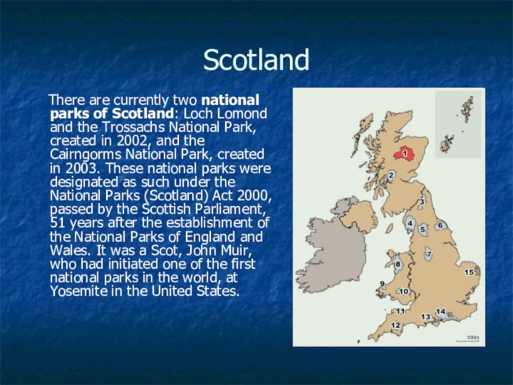
There are currently two national parks
of Scotland: Loch Lomond and the Trossachs National Park,
created in 2002, and the Cairngorms National Park, created in 2003. These national parks were designated as such under the National Parks (Scotland) Act 2000, passed by the Scottish Parliament, 51 years after the establishment of the National Parks of England and Wales. It was a Scot, John Muir, who had initiated one of the first national parks in the world, at Yosemite in the United States.
Слайд 17
Loch Lomond & The Trossachs National Park
Loch
Lomond and The Trossachs National Park is a national
park in Scotland centred on Loch Lomond, and includes several ranges of hills, the Trossachs being the most famous.It was the first of the two national parks established by the Scottish Parliament in 2002, the second being the Cairngorms National Park.
The park is the fourth largest in the British Isles, with a total area of 1,865 km² (720 mi²) and a boundary of some 350 km (220 mi) in length. It includes 21 Munros (including Ben Lomond, Ben Lui, Beinn Challuim, Ben More and two peaks called Ben Vorlich), 20 Corbetts, two forest parks (Queen Elizabeth, and Argyll) and 57 designated special nature conservation sites.
15,600 people live in the park, which is customarily split into four sections: Breadalbane, Loch Lomond, The Trossachs, and Argyll Forest Park.
Слайд 19
The Cairngorms National Park
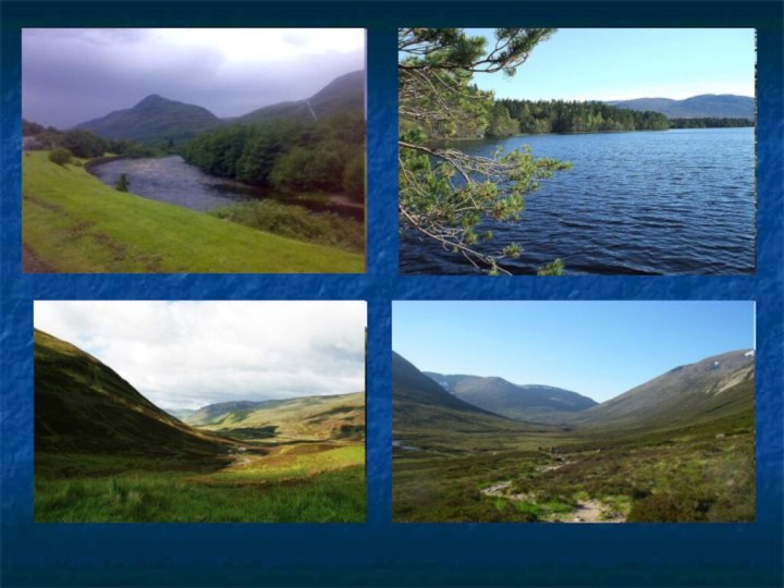
The Cairngorms National Park
is a national park in north east Scotland, established
in 2003.It was the second of two national parks established by the Scottish Parliament, after Loch Lomond and the Trossachs National Park, set up in 2002.
The park covers the Cairngorms range of mountains, and surrounding hills. Initially the largest national park in the British Isles.
Слайд 22
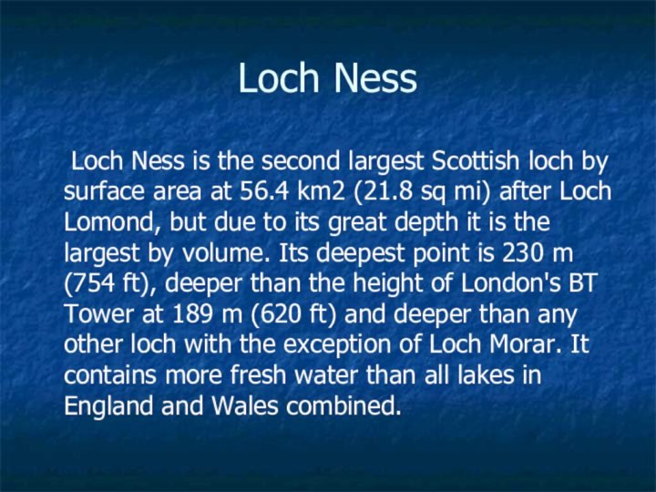
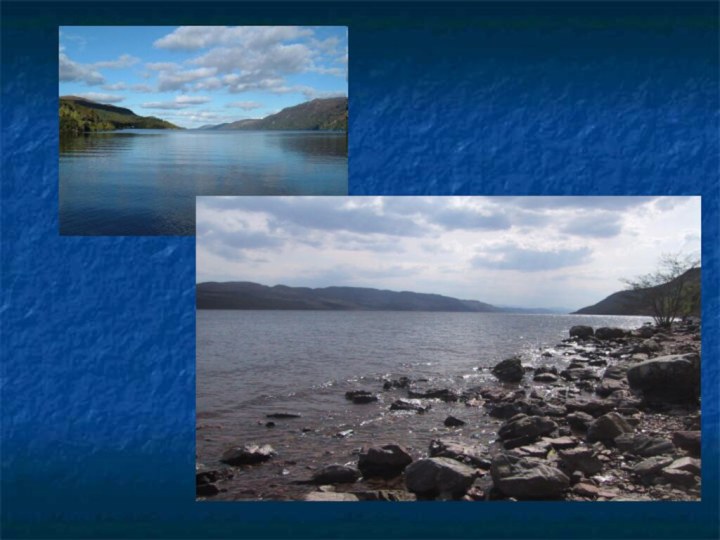
Loch Ness
Loch Ness is the second
largest Scottish loch by surface area at 56.4 km2 (21.8
sq mi) after Loch Lomond, but due to its great depth it is the largest by volume. Its deepest point is 230 m (754 ft), deeper than the height of London's BT Tower at 189 m (620 ft) and deeper than any other loch with the exception of Loch Morar. It contains more fresh water than all lakes in England and Wales combined.
Слайд 26
Snowdonia
It was established in 1951
It covers 827 square miles
(2,140 km2), and has 37 miles (60 km) of coastline.
Unlike national parks
in other countries, Snowdonia is made up of both public and private lands under central planning authority.More than 26,000 people live within the Park. The Park attracts over 6 million visitors annually, making it the third most visited National Park in England and Wales.
Слайд 28
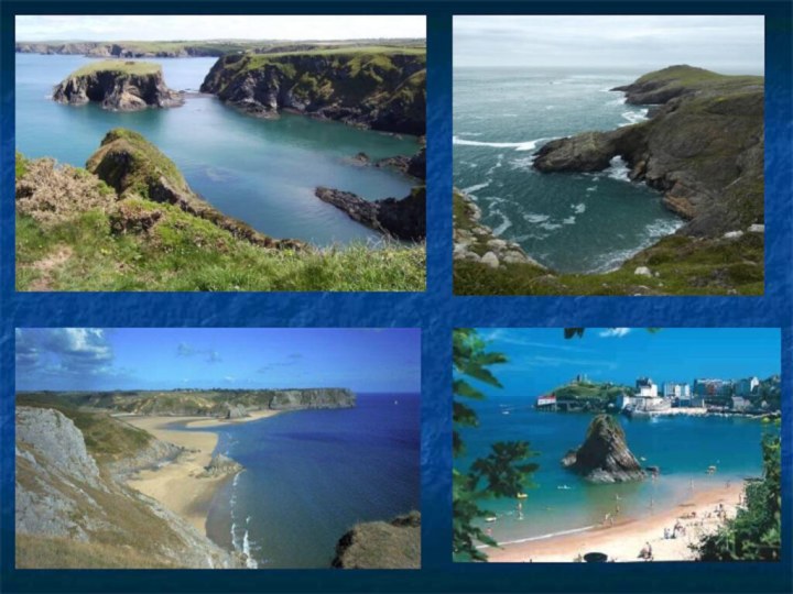
Pembrokeshire Coast National Park
Pembrokeshire Coast National Park is
a national park along the Pembrokeshire coast in West
Wales.It was established as a National Park in 1952.
The National Park covers a total area of 629 km² (240 square miles). It falls into four distinct sections. Running clockwise around the coast, these are
the south Pembrokeshire coast, including Caldey Island;
the Daugleddau estuary;
the St Bride's Bay coast, including the coastal islands;
the Preseli Hills.
It includes 7 Special Areas of Conservation, a Marine Nature Reserve, 6 National Nature Reserves and 75 Sites of Special Scientific Interest.
Слайд 30
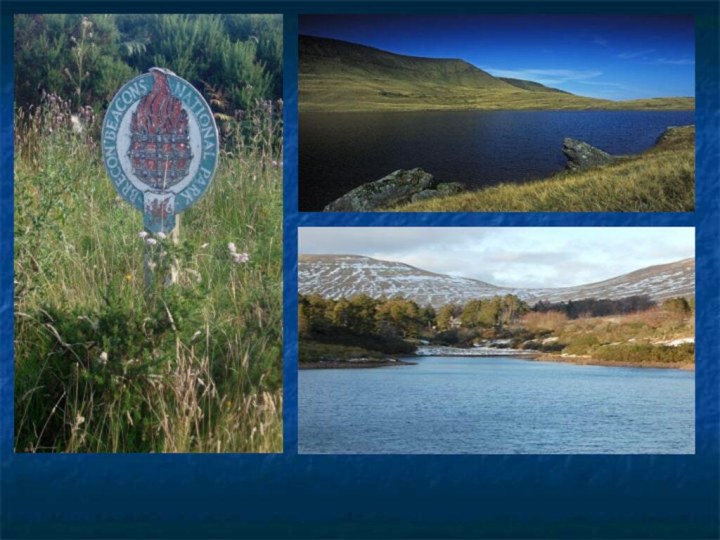
Brecon Beacons
It consists of the mountains to the
south of Brecon. The highest of these is Pen
y Fan (886 m)It was established in 1957, the last of the three Welsh parks.
It covers 519 square miles (1344 km²), from Llandeilo in the west to Hay-on-Wye in the east. It encompasses the ranges confusingly named the Black Mountains (in the east of the park) and the Black Mountain (in the west). The area to the west of the Brecon Beacons range is known as Fforest Fawr (Great Forest).
Most of the national park is moorland, with some forestry plantations, and pasture in the valleys. In 1966 the Brecon Beacons Mountain Centre was opened to visitors.
Activities in the park include walking, cycling, mountain biking, horse riding, as well as sailing, windsurfing, canoeing and fishing its rivers and reservoirs, rock climbing, hang-gliding, caravanning, camping and caving.
Слайд 32
Northern Ireland
There are, at present, no national
parks in Northern Ireland and moves to establish a
national park in the Mourne Mountains have proved to be controversial. If established, it would stretch from Carlingford Lough to Newcastle and Slieve Croob, creating a tourism boom and up to 2,000 jobs. On the other hand, there are fears that it could drive up prices of property.
Слайд 33
Mourne Mountains
A mountain range located in County Down
in the south-east of Northern Ireland. The surrounding area
is proposed as the first national park in Northern Ireland. The Mountains of Mourne are partly owned by the National Trust and see a large number of visitors every year. The highest mountain is Slieve Donard at 849 metres (2,790 ft).The Mourne Wall is a 35 kilometres (22 mi) dry-stone wall that crosses fifteen summits, constructed to define the boundaries of Belfast Water Commissioners in the late 1800s. Construction of the Mourne Wall was started in 1904 and was completed in 1922.
The Mournes are very popular as a destination for many Duke of Edinburgh's Award expeditions.
The Mountains were said to be C.S. Lewis' inspiration for the magical world of Narnia.


