- Главная
- Разное
- Бизнес и предпринимательство
- Образование
- Развлечения
- Государство
- Спорт
- Графика
- Культурология
- Еда и кулинария
- Лингвистика
- Религиоведение
- Черчение
- Физкультура
- ИЗО
- Психология
- Социология
- Английский язык
- Астрономия
- Алгебра
- Биология
- География
- Геометрия
- Детские презентации
- Информатика
- История
- Литература
- Маркетинг
- Математика
- Медицина
- Менеджмент
- Музыка
- МХК
- Немецкий язык
- ОБЖ
- Обществознание
- Окружающий мир
- Педагогика
- Русский язык
- Технология
- Физика
- Философия
- Химия
- Шаблоны, картинки для презентаций
- Экология
- Экономика
- Юриспруденция
Что такое findslide.org?
FindSlide.org - это сайт презентаций, докладов, шаблонов в формате PowerPoint.
Обратная связь
Email: Нажмите что бы посмотреть
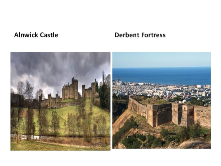
Презентация на тему открытого урока по английскому языку : Замок Алнвик в Нортумберленде и Дербентская крепость в Дагестане.
Содержание
- 2. Alnwick Castle is a castle and stately home in the town
- 3. The history of Alnwick is the history
- 4. Hulne Priory, outside the town walls in Hulne
- 5. The River Aln forms its unofficial northern boundary. Historically,
- 6. By the time of the 2011 Census
- 7. Brizlee Tower, a folly and observation platform overlooking Hulne
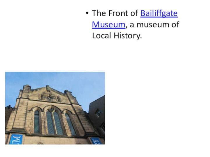
- 8. The Front of Bailiffgate Museum, a museum of Local History.
- 9. This fame has much to do with
- 10. Other places of interest in and near
- 11. Born in Alnwick[edit]William of Alnwick, (c. 1275–1333),
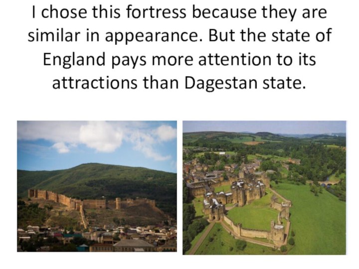
- 12. Derbent fortress
- 13. Derbent is a city in the Republic of Dagestan, Russia, located on
- 14. The city's name derives from the Persian Darband (دربند), meaning
- 15. Derbent's location on a narrow, three-kilometer strip
- 16. Within the framework of administrative divisions, Derbent serves
- 17. Within the framework of administrative divisions, Derbent serves
- 18. The city is home to machine building,
- 19. Derbent resembles a huge museum and has
- 20. A large portion of the walls and
- 21. Notable people[edit]Bella Nisan, ophthalmologistIgor Yusufov, politicianIsrael Tsvaygenbaum,
- 22. Скачать презентацию
- 23. Похожие презентации
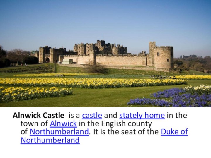
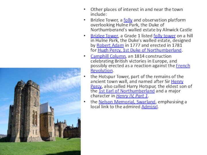
Alnwick Castle is a castle and stately home in the town of Alnwick in the English county of Northumberland. It is the seat of the Duke of Northumberland
![Презентация открытого урока по английскому языку : Замок Алнвик в Нортумберленде и Дербентская крепость в Дагестане. Born in Alnwick[edit]William of Alnwick, (c. 1275–1333), Franciscan theologian and Bishop of](/img/tmb/6/529681/b1837f7b096dae750aa131f008a706c7-720x.jpg)
![Презентация открытого урока по английскому языку : Замок Алнвик в Нортумберленде и Дербентская крепость в Дагестане. Notable people[edit]Bella Nisan, ophthalmologistIgor Yusufov, politicianIsrael Tsvaygenbaum, artistMushail Mushailov, artist and teacherSergey](/img/tmb/6/529681/abab159f124f667371df3535ff383181-720x.jpg)
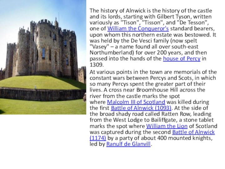
Слайд 3 The history of Alnwick is the history of
the castle and its lords, starting with Gilbert Tyson,
written variously as "Tison", "Tisson", and "De Tesson", one of William the Conqueror's standard bearers, upon whom this northern estate was bestowed. It was held by the De Vesci family (now spelt "Vasey" – a name found all over south-east Northumberland) for over 200 years, and then passed into the hands of the house of Percy in 1309.At various points in the town are memorials of the constant wars between Percys and Scots, in which so many Percys spent the greater part of their lives. A cross near Broomhouse Hill across the river from the castle marks the spot where Malcolm III of Scotland was killed during the first Battle of Alnwick (1093). At the side of the broad shady road called Ratten Row, leading from the West Lodge to Bailiffgate, a stone tablet marks the spot where William the Lion of Scotland was captured during the second Battle of Alnwick (1174) by a party of about 400 mounted knights, led by Ranulf de Glanvill.
Слайд 4
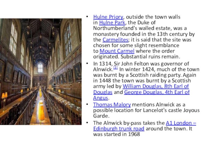
Hulne Priory, outside the town walls in Hulne Park,
the Duke of Northumberland's walled estate, was a monastery
founded in the 13th century by the Carmelites; it is said that the site was chosen for some slight resemblance to Mount Carmel where the order originated. Substantial ruins remain.In 1314, Sir John Felton was governor of Alnwick.[3] In winter 1424, much of the town was burnt by a Scottish raiding party. Again in 1448 the town was burnt by a Scottish army led by William Douglas, 8th Earl of Douglas and George Douglas, 4th Earl of Angus.
Thomas Malory mentions Alnwick as a possible location for Lancelot's castle Joyous Garde.
The Alnwick by-pass takes the A1 London – Edinburgh trunk road around the town. It was started in 1968
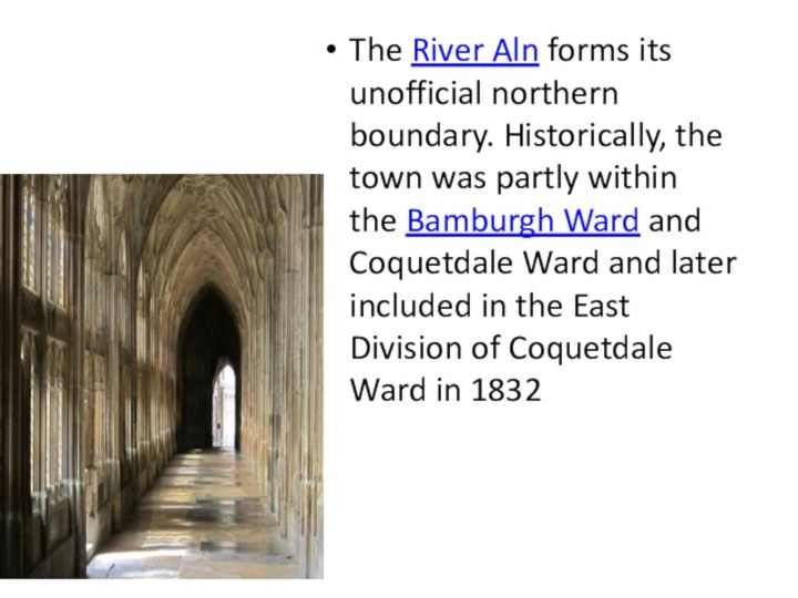
Слайд 5 The River Aln forms its unofficial northern boundary. Historically, the
town was partly within the Bamburgh Ward and Coquetdale Ward and
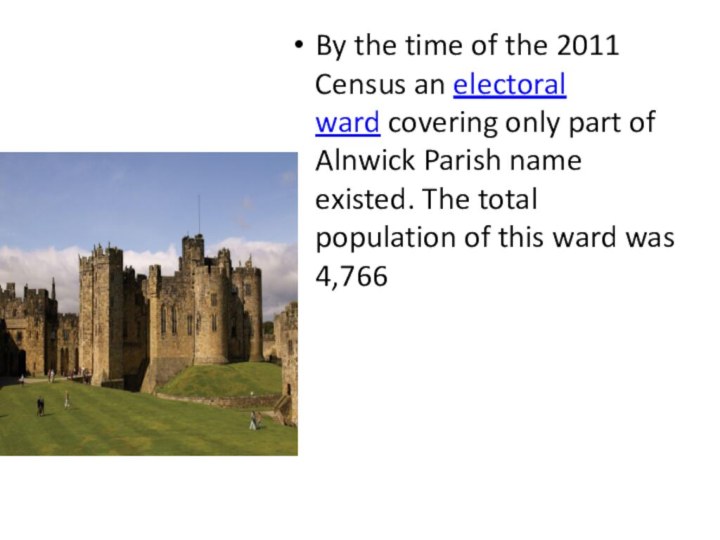
later included in the East Division of Coquetdale Ward in 1832Слайд 6 By the time of the 2011 Census an electoral
ward covering only part of Alnwick Parish name existed. The
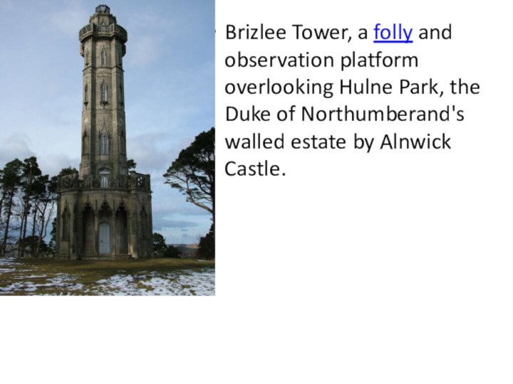
total population of this ward was 4,766Слайд 7 Brizlee Tower, a folly and observation platform overlooking Hulne Park,
the Duke of Northumberand's walled estate by Alnwick Castle.
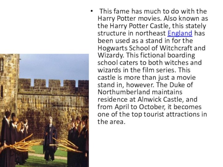
Слайд 9 This fame has much to do with the
Harry Potter movies. Also known as the Harry Potter
Castle, this stately structure in northeast England has been used as a stand in for the Hogwarts School of Witchcraft and Wizardy. This fictional boarding school caters to both witches and wizards in the film series. This castle is more than just a movie stand in, however. The Duke of Northumberland maintains residence at Alnwick Castle, and from April to October, it becomes one of the top tourist attractions in the area.Слайд 10 Other places of interest in and near the
town include:
Brizlee Tower, a folly and observation platform overlooking Hulne Park,
the Duke of Northumberand's walled estate by Alnwick CastleBrizlee Tower, a Grade 1 listed folly tower on a hill in Hulne Park, the Duke's walled estate, designed by Robert Adam in 1777 and erected in 1781 for Hugh Percy, 1st Duke of Northumberland.
Camphill Column, an 1814 construction celebrating British victories in Europe, and possibly erected as a reaction against the French Revolution.
the Hotspur Tower, part of the remains of the ancient town wall, and named after Sir Henry Percy, also called Harry Hotspur, the eldest son of the 1st Earl of Northumberland and a major character in Henry IV, Part 1.
the Nelson Memorial, Swarland, emphasising a local link to the admired Admiral.
Слайд 11
Born in Alnwick[edit]
William of Alnwick, (c. 1275–1333), Franciscan
theologian and Bishop of Giovinazzo
William Henry Percy (1788–1855), naval commander
and politician.George Biddell Airy, (1801–1892), Astronomer Royal from 1835 to 1881
Bernard Bosanquet, (1848–1923), philosopher
John Busby, (1765–1857), mining engineer
Jeremy Darroch, chief executive of British Sky Broadcasting (BSkyB)
William Davison (1781–1858) pharmacist, apothecary, printer, etc.
Stella Vine
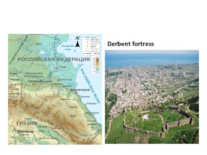
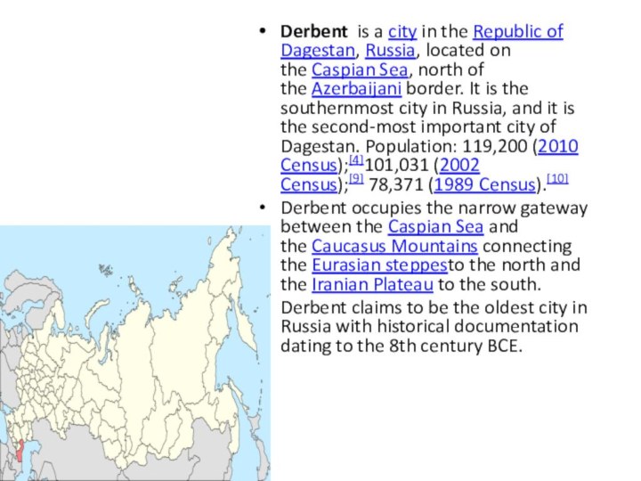
Слайд 13 Derbent is a city in the Republic of Dagestan, Russia, located on the Caspian
Sea, north of the Azerbaijani border. It is the southernmost city
in Russia, and it is the second-most important city of Dagestan. Population: 119,200 (2010 Census);[4]101,031 (2002 Census);[9] 78,371 (1989 Census).[10]Derbent occupies the narrow gateway between the Caspian Sea and the Caucasus Mountains connecting the Eurasian steppesto the north and the Iranian Plateau to the south.
Derbent claims to be the oldest city in Russia with historical documentation dating to the 8th century BCE.
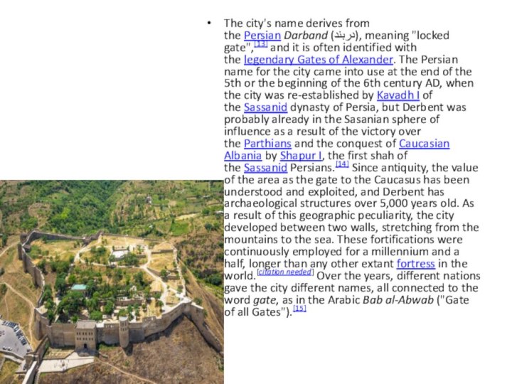
Слайд 14 The city's name derives from the Persian Darband (دربند), meaning "locked
gate",[13] and it is often identified with the legendary Gates of
Alexander. The Persian name for the city came into use at the end of the 5th or the beginning of the 6th century AD, when the city was re-established by Kavadh I of the Sassanid dynasty of Persia, but Derbent was probably already in the Sasanian sphere of influence as a result of the victory over the Parthians and the conquest of Caucasian Albania by Shapur I, the first shah of the Sassanid Persians.[14] Since antiquity, the value of the area as the gate to the Caucasus has been understood and exploited, and Derbent has archaeological structures over 5,000 years old. As a result of this geographic peculiarity, the city developed between two walls, stretching from the mountains to the sea. These fortifications were continuously employed for a millennium and a half, longer than any other extant fortress in the world.[citation needed] Over the years, different nations gave the city different names, all connected to the word gate, as in the Arabic Bab al-Abwab ("Gate of all Gates").[15]Слайд 15 Derbent's location on a narrow, three-kilometer strip of
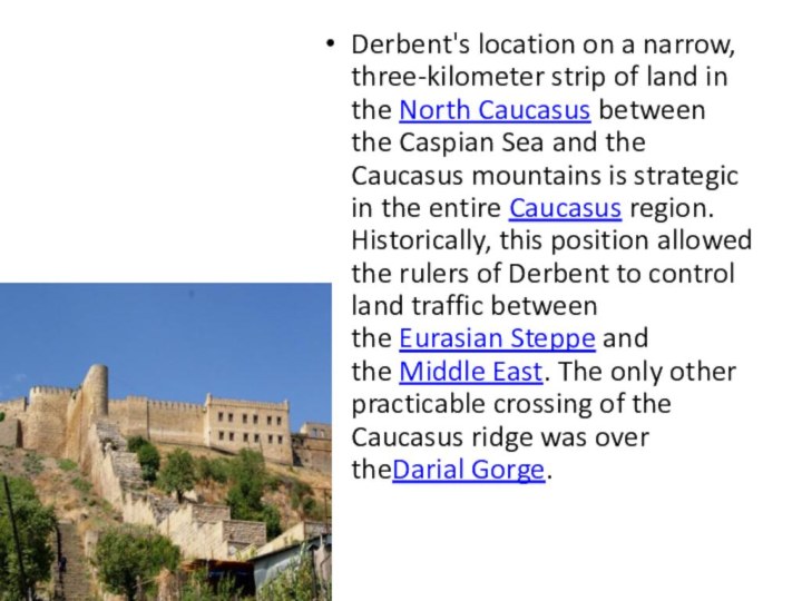
land in the North Caucasus between the Caspian Sea and the
Caucasus mountains is strategic in the entire Caucasus region. Historically, this position allowed the rulers of Derbent to control land traffic between the Eurasian Steppe and the Middle East. The only other practicable crossing of the Caucasus ridge was over theDarial Gorge.Слайд 16 Within the framework of administrative divisions, Derbent serves as
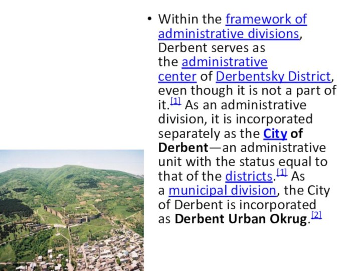
the administrative center of Derbentsky District, even though it is not a
part of it.[1] As an administrative division, it is incorporated separately as the City of Derbent—an administrative unit with the status equal to that of the districts.[1] As a municipal division, the City of Derbent is incorporated as Derbent Urban Okrug.[2]Слайд 17 Within the framework of administrative divisions, Derbent serves as
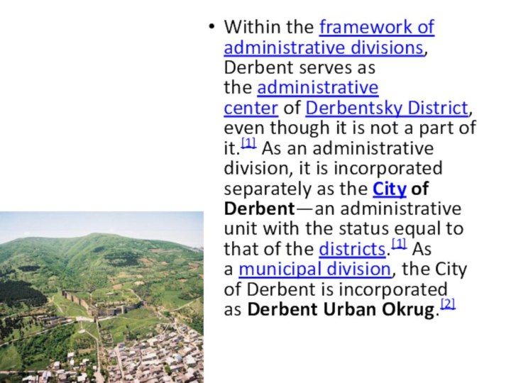
the administrative center of Derbentsky District, even though it is not a
part of it.[1] As an administrative division, it is incorporated separately as the City of Derbent—an administrative unit with the status equal to that of the districts.[1] As a municipal division, the City of Derbent is incorporated as Derbent Urban Okrug.[2]Слайд 18 The city is home to machine building, food,
textile, fishing and fishery supplies, construction materials and wood
industries. It is the center of Russian brandy production. The educational infrastructure includes a university as well as several technical schools. On the cultural front, there is a Lezgin drama theater (named after S. Stalsky). About two kilometers (1.2 miles) from the city is the vacation colony of Chayka (Seagull).The Soviet novelist Yury Krymov named a fictional motor tanker after the city in his book The Tanker "Derbent".
Слайд 19 Derbent resembles a huge museum and has magnificent
mountains and shore nearby, and therefore possesses much touristic
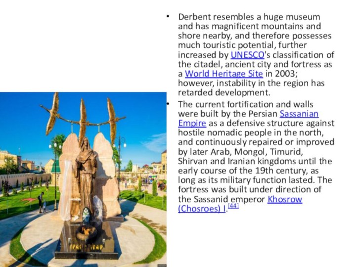
potential, further increased by UNESCO's classification of the citadel, ancient city and fortress as a World Heritage Site in 2003; however, instability in the region has retarded development.The current fortification and walls were built by the Persian Sassanian Empire as a defensive structure against hostile nomadic people in the north, and continuously repaired or improved by later Arab, Mongol, Timurid, Shirvan and Iranian kingdoms until the early course of the 19th century, as long as its military function lasted. The fortress was built under direction of the Sassanid emperor Khosrow (Chosroes) I.[44]
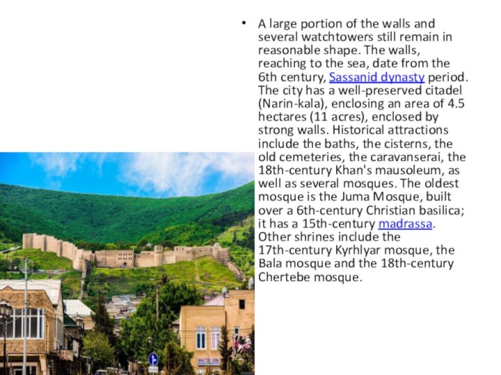
Слайд 20 A large portion of the walls and several
watchtowers still remain in reasonable shape. The walls, reaching
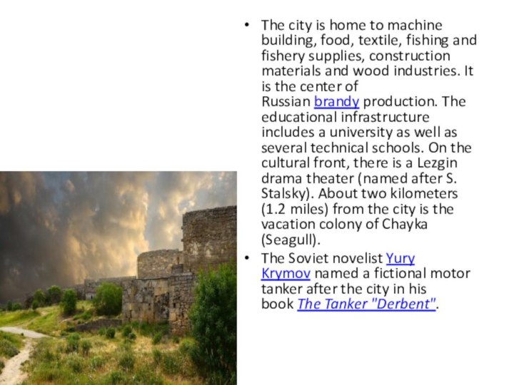
to the sea, date from the 6th century, Sassanid dynasty period. The city has a well-preserved citadel (Narin-kala), enclosing an area of 4.5 hectares (11 acres), enclosed by strong walls. Historical attractions include the baths, the cisterns, the old cemeteries, the caravanserai, the 18th-century Khan's mausoleum, as well as several mosques. The oldest mosque is the Juma Mosque, built over a 6th-century Christian basilica; it has a 15th-century madrassa. Other shrines include the 17th-century Kyrhlyar mosque, the Bala mosque and the 18th-century Chertebe mosque.
Слайд 21
Notable people[edit]
Bella Nisan, ophthalmologist
Igor Yusufov, politician
Israel Tsvaygenbaum, artist
Mushail
Mushailov, artist and teacher
Sergey Izgiyayev, poet, playwright and translator
of Mountain Jewish descentSuleyman Kerimov, businessman, investor and politician.
Tamara Musakhanova, sculptor and ceramist
Yagutil Mishiev, writer
Twin towns and sister cities[edit]


