- Главная
- Разное
- Бизнес и предпринимательство
- Образование
- Развлечения
- Государство
- Спорт
- Графика
- Культурология
- Еда и кулинария
- Лингвистика
- Религиоведение
- Черчение
- Физкультура
- ИЗО
- Психология
- Социология
- Английский язык
- Астрономия
- Алгебра
- Биология
- География
- Геометрия
- Детские презентации
- Информатика
- История
- Литература
- Маркетинг
- Математика
- Медицина
- Менеджмент
- Музыка
- МХК
- Немецкий язык
- ОБЖ
- Обществознание
- Окружающий мир
- Педагогика
- Русский язык
- Технология
- Физика
- Философия
- Химия
- Шаблоны, картинки для презентаций
- Экология
- Экономика
- Юриспруденция
Что такое findslide.org?
FindSlide.org - это сайт презентаций, докладов, шаблонов в формате PowerPoint.
Обратная связь
Email: Нажмите что бы посмотреть
Презентация на тему по английскому языку на тему География Великобритании
Содержание
- 2. The UK of Great Britain and Northern
- 3. The British Isles is a geographical name
- 4. Great Britain is an island
- 5. Islands In total, it
- 6. There are no high mountains in Great
- 7. The British Isles have many rivers but
- 8. The Thames is over 200 miles long.
- 9. The UK is known for its beautiful
- 10. The climateThe climate of Great Britain is
- 11. Great Britain consists of England, Scotland, Wales and Northern Ireland.
- 12. England is situated in the central and
- 13. London is Britain’s and England’s capital
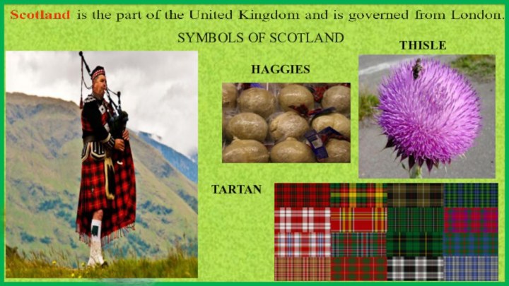
- 14. SYMBOLS OF SCOTLANDTHISLETARTANHAGGIES
- 15. Wales is a small country, bounded on
- 16. Northern Ireland is the second largest of
- 17. Скачать презентацию
- 18. Похожие презентации
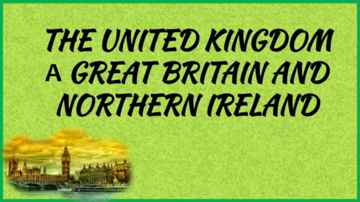
The UK of Great Britain and Northern Ireland is the official name of the state that is geographically situated on the British Isles.







Слайд 3 The British Isles is a geographical name of
an archipelago , which is situated to the northwest
of continental Europe and is separated from France by only 34 kilometers of water and is made up of two large islands – Great Britain and Ireland and a number of smaller islands.The UK is one of the smallest countries in the world. In size it is twice smaller than Spain or France. It is total area is about 245, 000 square kilometers, but the population of the UK is over 60 million people.
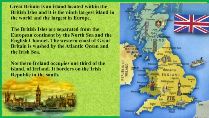
Слайд 4 Great Britain is an island located
within the British Isles and it is the ninth
largest island in the world and the largest in Europe. The British Isles are separated from the European continent by the North Sea and the English Channel. The western coast of Great Britain is washed by the Atlantic Ocean and the Irish Sea. Northern Ireland occupies one third of the island, of Ireland. It borders on the Irish Republic in the south.
Слайд 5
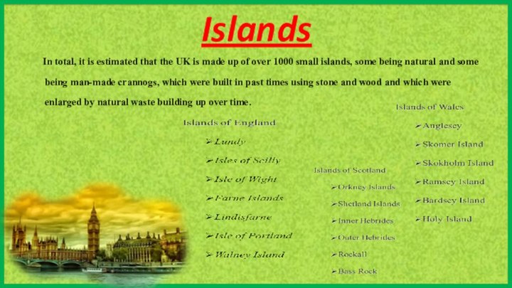
Islands
In total, it is
estimated that the UK is made up of over
1000 small islands, some being natural and some being man-made crannogs, which were built in past times using stone and wood and which were enlarged by natural waste building up over time.Слайд 6 There are no high mountains in Great Britain.
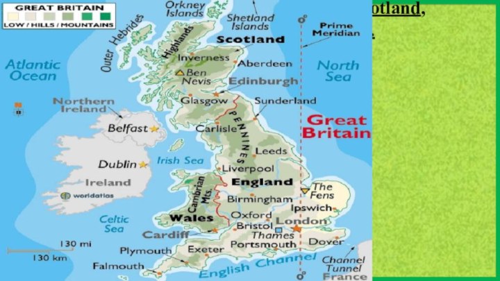
In the north the Cheviots separate England from Scotland,
the Pennines stretch down North England almost along its middle, the Cambrian mountains occupy the greater part of Wales and the Highlands of Scotland, are the tallest of the British mountains. There is very little flat country except in the region known as East Anglia.Слайд 7 The British Isles have many rivers but they
are not very long. The longest of the English
rivers is the Severn. It flows into the Irish Sea. The most important river of Scotland is the Clyde. Glasgow stands on it. Many of the English and Scottish rivers are joined by canals, so that it is possible to travel by water from one end of Great Britain to the other.Слайд 8 The Thames is over 200 miles long. It
flows through the rich agricultural and industrial districts of
the country. London, the capital of Great Britain, stands on it. The Thames has a wide mouth, that's why the big ocean liners can go up to the London port.Слайд 9 The UK is known for its beautiful lakes.
Most of them are in Scotland and north-west of
England. Scottish valleys are filled with lakes. These lakes are called "lochs". There are two kinds of lakes — lakes with fresh water like Loch Ness and lakes like Norwegian fjords
Слайд 10
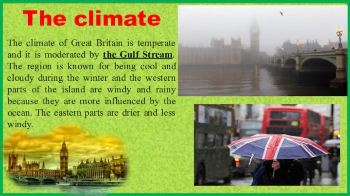
The climate
The climate of Great Britain is temperate
and it is moderated by the Gulf Stream. The
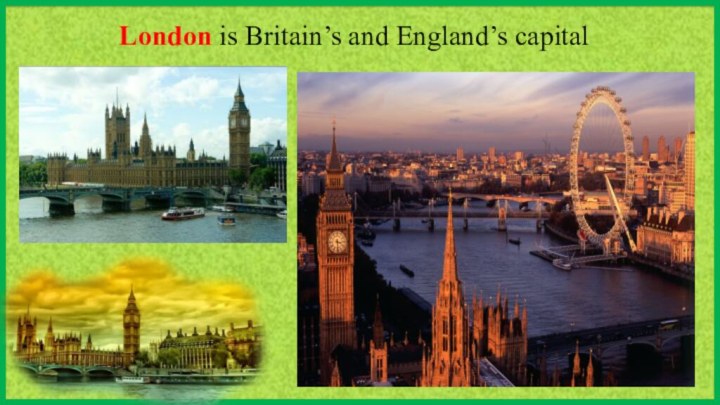
region is known for being cool and cloudy during the winter and the western parts of the island are windy and rainy because they are more influenced by the ocean. The eastern parts are drier and less windy.Слайд 12 England is situated in the central and southern
parts of Great Britain. London is Britain’s and England’s capital
RED BOX
RED ROSE
BIG BEN
Слайд 15 Wales is a small country, bounded on the
north and west by the Irish Sea, and on
the south by the Bristol Channel.DAFFODIL
LEEK
RED DRAGON
Слайд 16 Northern Ireland is the second largest of the
British Islands lying in the Atlantic of the west
coast of Great Britain.SHAMROCK
RED HAND
Leprechaun


