- Главная
- Разное
- Бизнес и предпринимательство
- Образование
- Развлечения
- Государство
- Спорт
- Графика
- Культурология
- Еда и кулинария
- Лингвистика
- Религиоведение
- Черчение
- Физкультура
- ИЗО
- Психология
- Социология
- Английский язык
- Астрономия
- Алгебра
- Биология
- География
- Геометрия
- Детские презентации
- Информатика
- История
- Литература
- Маркетинг
- Математика
- Медицина
- Менеджмент
- Музыка
- МХК
- Немецкий язык
- ОБЖ
- Обществознание
- Окружающий мир
- Педагогика
- Русский язык
- Технология
- Физика
- Философия
- Химия
- Шаблоны, картинки для презентаций
- Экология
- Экономика
- Юриспруденция
Что такое findslide.org?
FindSlide.org - это сайт презентаций, докладов, шаблонов в формате PowerPoint.
Обратная связь
Email: Нажмите что бы посмотреть
Презентация на тему Multirotor UAV in project 14.B37.21.1243
Содержание
- 2. UAV developed in MIIGAiKSCB “Impulse”SCB “Krechet”
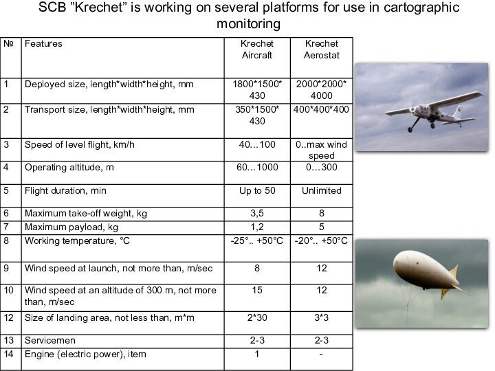
- 3. SCB ”Krechet” is working on several platforms for use in cartographic monitoring
- 5. Multirotor UAV, which is developed in SCB
- 6. Functions & elements of ground control
- 7. Data, which is receiving by operators
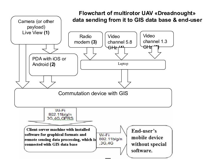
- 8. Flowchart of multirotor UAV «Dreadnought» data sending from it to GIS data base & end-user
- 9. What can you find in UAV payload?
- 10. Examples of UAV “Dreadnought” survey: Altitude: 100
- 11. Geodesic range3D terrain model. Perspective view
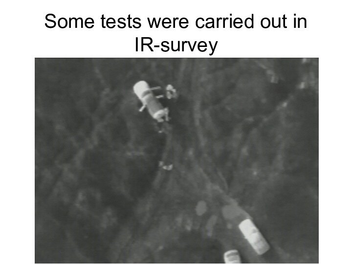
- 12. Some tests were carried out in IR-survey
- 13. Survey of fires in Smolensk region, near town Gagarin, with wide-angle camera lens
- 14. The ways of multirotor UAV usage in
- 15. Скачать презентацию
- 16. Похожие презентации
UAV developed in MIIGAiKSCB “Impulse”SCB “Krechet”

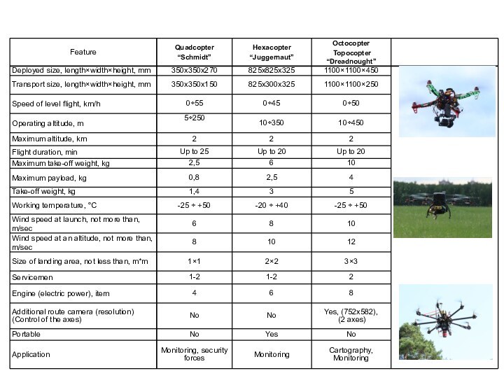
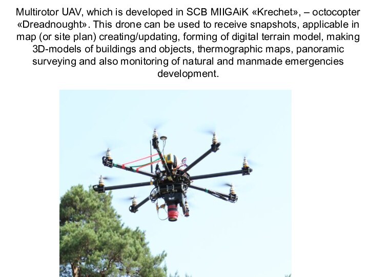




Слайд 5 Multirotor UAV, which is developed in SCB MIIGAiK
«Krechet», – octocopter «Dreadnought». This drone can be used to
receive snapshots, applicable in map (or site plan) creating/updating, forming of digital terrain model, making 3D-models of buildings and objects, thermographic maps, panoramic surveying and also monitoring of natural and manmade emergencies development.
Слайд 6
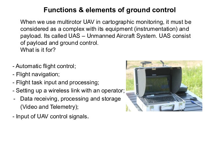
Functions & elements of ground control
When we use multirotor UAV in cartographic monitoring, it
must be considered as a complex with its equipment (instrumentation) and payload. Its called UAS – Unmanned Aircraft System. UAS consist of payload and ground control. What is it for?- Automatic flight control;
- Flight navigation;
- Flight task input and processing;
- Setting up a wireless link with an operator;
Data receiving, processing and storage
(Video and Telemetry);
- Input of UAV control signals.
Слайд 9
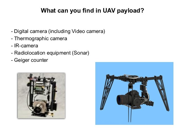
What can you find in UAV payload?
- Digital
camera (including Video camera)
- Thermographic camera
- IR-camera
- Radiolocation equipment
(Sonar)- Geiger counter
Слайд 10 Examples of UAV “Dreadnought” survey: Altitude: 100 meters Camera: Canon
550D Camera lens: 18 mm Overlap: 65% Flight duration: 8 minutes Flight speed
on a route: 5 meters/secСлайд 14 The ways of multirotor UAV usage in environment
monitoring:
Cartographic monitoring
Topographic survey
Multispectral survey
Thermographic survey
Geology
Cadastre (stereo image)
Emergency control
Tasks
of agro-industrial complexSnapshots for 3D modeling
Agriculture: control of farms & fields condition
Ecological monitoring:
- radiation;
- chemical pollution;
- bacteriological pollution.


