- Главная
- Разное
- Бизнес и предпринимательство
- Образование
- Развлечения
- Государство
- Спорт
- Графика
- Культурология
- Еда и кулинария
- Лингвистика
- Религиоведение
- Черчение
- Физкультура
- ИЗО
- Психология
- Социология
- Английский язык
- Астрономия
- Алгебра
- Биология
- География
- Геометрия
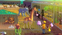
- Детские презентации
- Информатика
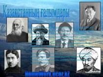
- История
- Литература
- Маркетинг
- Математика
- Медицина
- Менеджмент
- Музыка
- МХК
- Немецкий язык
- ОБЖ
- Обществознание
- Окружающий мир
- Педагогика
- Русский язык
- Технология
- Физика
- Философия
- Химия
- Шаблоны, картинки для презентаций
- Экология
- Экономика
- Юриспруденция
Что такое findslide.org?
FindSlide.org - это сайт презентаций, докладов, шаблонов в формате PowerPoint.
Обратная связь
Email: Нажмите что бы посмотреть
Презентация на тему по теме :Географическое положение Канады
Содержание
- 2. TeachersPrint off the following slide for each
- 4. PhysicalFeatures
- 5. Great Lakes5 large freshwater lakes in central
- 8. St Lawrence RiverMajor source of overseas and
- 11. St Lawrence SeawayA canal completed in 1959
- 14. Hudson BayHUGE inland sea in east central
- 18. Atlantic OceanThis is the 2nd largest of
- 19. Pacific OceanLargest & deepest of the world’s
- 20. Canadian ShieldStretches from Great Lakes to Arctic
- 23. Rocky MountainsMountains located in Western CanadaIncludes western
- 27. Be the Thing…Your Task: Choose 1 of
- 28. Example:Brrrrr! I am always so cold!! It’s
- 29. Canadian Shield!
- 30. Where People Live&How They Trade
- 31. TeachersProject the following slide on the board/wall,
- 32. Let’s Review: Physical Features
- 33. Location2nd largest country in the world (Russia
- 35. Location & TradeCanada’s location in the world
- 36. ClimateSoutheastern part of Canada has a MUCH
- 37. Climate & TradeCanada’s location in the world
- 38. Natural ResourcesRich in natural resources: coal, oil,
- 39. N.R. & TradeSells oil and natural gas,
- 41. Pack Your BagsInside of the suitcase, draw
- 43. TeachersI give my students the following handout
- 47. Скачать презентацию
- 48. Похожие презентации
TeachersPrint off the following slide for each student. They should complete the chart while discussing the presentation.


Слайд 2
Teachers
Print off the following slide for each student.
They should complete the chart while discussing the presentation.
Слайд 5
Great Lakes
5 large freshwater lakes in central North
America
HOMES (Huron, Ontario, Michigan, Erie, Superior)
Serve as the “industrial
heartland” of the continent because of all of the factoriesOne of the world’s busiest shipping areas
Most of Canada’s population lives in this region
Слайд 8
St Lawrence River
Major source of overseas and US/Canada
shipping & trade
Shortcut that connects the Great Lakes to
the Atlantic OceanHuge producer of hydroelectricity
Слайд 11
St Lawrence Seaway
A canal completed in 1959 at
the eastern end of the Great Lakes
Connects the Great
Lakes with the St. Lawrence River (which flows to the Atlantic Ocean)Major source of overseas and US/Canada shipping & trade
Closed from November to April (frozen)
Seaway has made cities in Eastern Canada home to many successful manufacturing companies
Слайд 14
Hudson Bay
HUGE inland sea in east central Canada
“an
arm” of the Atlantic Ocean
Grain from Alberta & Saskatchewan
is shipped from Hudson Bay out to the Atlantic and on to other countriesOnly navigable from July to October
Слайд 18
Atlantic Ocean
This is the 2nd largest of the
earth’s 5 oceans.
It’s also the most heavily traveled ocean.
It
forms the eastern border of Canada.It’s a major shipping route to Europe & Africa.
Слайд 19
Pacific Ocean
Largest & deepest of the world’s 5
oceans
Covers 1/3 of the earth’s surface!
Western border of Canada
Major
shipping route to Asia
Слайд 20
Canadian Shield
Stretches from Great Lakes to Arctic Ocean;
covers half of Canada!
Horseshoe region around Hudson Bay
Region of
mostly thin soil lying on top of rock, with many bare outcrops of rock & thousands of lakesMajor source of natural resources: timber, minerals, & water
Region is sparsely populated.
Слайд 23
Rocky Mountains
Mountains located in Western Canada
Includes western Alberta
and eastern British Columbia
Stretch a distance of 2,000 miles!
Mining
is the biggest industry in the region, followed closely by logging.Major minerals include: iron ore, copper, coal, gold.
Sparsely populated & contain few cities
Слайд 27
Be the Thing…
Your Task:
Choose 1 of the
physical features
Fold your paper “hamburger style” to make a
desk tentOn the front : Imagine that you are one of the features. Write 5 facts about yourself.
On the back: draw an illustration of the feature
We will walk around and try to guess the features!
Слайд 28
Example:
Brrrrr! I am always so cold!! It’s chilly
up here in northern Canada. I am so tired
of everybody always picking on me. Dig, dig, dig all day long. I wish I had some pretty trees to look at…All that I can see is scraggly trees and flat, rocky land. It’s so lonely. No one lives near me.
Слайд 31
Teachers
Project the following slide on the board/wall, and
have students point out or label the physical features.
Слайд 33
Location
2nd largest country in the world (Russia is
larger)
Surrounded by three oceans: Atlantic, Arctic, & Pacific
Southern border
is the USAlaska also forms part of the western border.
Population is 33 million, which is small compared to its size (US population is 9 times larger!)
90 percent of population lives within 100 miles of the US-Canadian border…WHY?
Слайд 35
Location & Trade
Canada’s location in the world helps
it to be a leader in world trade:
It’s uniquely
located on 3 oceans, so it has opportunities to trade with Europe & Asia.Great Lakes and the St. Lawrence Seaway allow goods to be shipped to and from central Canada and the Atlantic Ocean
A major benefit for Canada is its border with the US (#1 trading partner).
Share over 3,000 miles of border & trade is relatively easy
80% of Canada’s exports come to US
Слайд 36
Climate
Southeastern part of Canada has a MUCH warmer
climate than the rest of the country.
Warm to hot
summers & cold wintersAllows for a long growing season
Pacific coast has a temperate climate.
Pacific ocean cools the region in summer and warms it in winter.
Over 100 inches of precipitation per year
Northern Canada is COLD!
Few people live here – temperatures can be below freezing even in summer!
Слайд 37
Climate & Trade
Canada’s location in the world helps
it to be a leader in world trade:
It’s uniquely
located on 3 oceans, so it has opportunities to trade with Europe & Asia.Great Lakes and the St. Lawrence Seaway allow goods to be shipped to and from central Canada and the Atlantic Ocean
A major benefit for Canada is its border with the US (#1 trading partner).
Share over 3,000 miles of border & trade is relatively easy
80% of Canada’s exports come to US
Слайд 38
Natural Resources
Rich in natural resources:
coal, oil, natural
gas, iron ore, nickel, zinc, copper, gold, lead, molybdenum,
potash, diamonds, & silverRivers and lakes have an abundance of fish, fresh water, & hydroelectric power.
Good soil allows farmers to grow crops for Canadians--with enough left over to trade with other countries
Timber is also a major natural resource.
Слайд 39
N.R. & Trade
Sells oil and natural gas, fish,
agricultural products, & timber to other countries
Hydroelectricity is used
in Canada and also sold to the US.5% of the land in Canada is arable (actually a large amount because there is so much land).
Rich soil produces valuable crops that are consumed in Canada and traded to other countries.
Слайд 41
Pack Your Bags
Inside of the suitcase, draw FIVE
things that you are going to take with you
on our class trip to Canada.Think about the location, climate, physical features, and natural resources of the country. Look in your notebook for clues about what you might need on your trip.
Next, include a brief description of why you chose to bring that particular item.
Color your suitcase—be creative!
Example: I’m bringing a snowboard so that I can go down the Rocky Mountains!
Слайд 43
Teachers
I give my students the following handout at